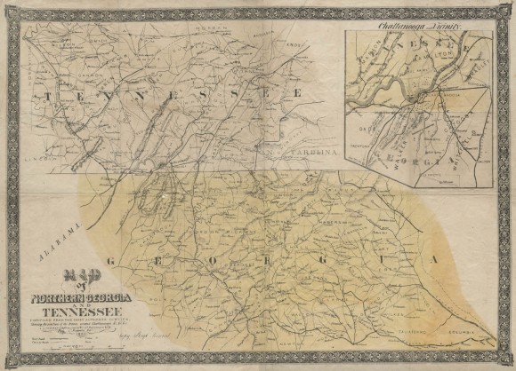
Map of Northern Georgia and Tennessee

- Creator: J.T. Paterson & Co., Augusta, GA
- Title: Map of Northern Georgia and Tennessee
- Date: 1863
- Description: Color topographic map showing lower central portion of East Tennessee and upper portion of Northwest Georgia with inset showing Chattanooga and vicinity. Has ornamental border with stylized floral design.
- Historical Note: This map shows the topography of the Tennessee River valley at Chattanooga's Moccasin Bend. The battles of Chickamauga and Lookout Mountain in 1863 were fought on this rugged terrain, which was the gateway for Union occupation of the Atlantic South. The caption under the title: "Showing the positions of the Armies around Chattanooga" suggests that the map may have been published soon after the battles in order to satisfy public curiosity about participating regiments and their strategic locations.
- Contributing Institution: Vanderbilt University Libraries
- Rights: Images reproduced on this website are intended for individual, educational use only. For research inquiries about specific objects or requests for high resolution images, contact the Vanderbilt Special Collections and University Archives.
- Digital Publisher: Digital Initiatives, James E. Walker Library, Middle Tennessee State University
- URL: http://cdm15838.contentdm.oclc.org/cdm/landingpage/collection/shades


