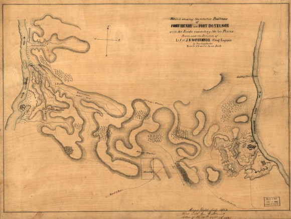
Sketch Showing Positions of Fort Henry and Fort Donelson, with the Roads Connecting the two Places

- Creator: Charles Lambecker
- Title: Sketch Showing Positions of Fort Henry and Fort Donelson, with the Roads Connecting the two Places
- Date: ca. 1862
- Description: This map, drawn in black ink, with the Tennessee and Cumberland Rivers in blue, shows telegraph lines between Forts Henry and Donelson in red, the names of some landowners, directions toward cities. It also indicates the topography using cross-hatched lines, trees with small shaded circles, and the town of Dover as a shaded grid of town blocks. Inscribed at lower right "Engrs Dept. July 1861 (4?) rec'd with Gen. Callum's letter of 16th inst (C 5021)," and titled " Sketch Showing Positions of Fort Henry and Fort Donelson, with the roads connecting the two places, drawn under direction of Lt Col J.B. McPherson, Chief Engineer"
- Historical Note: This map was created by federal engineers to illustrate the movement of troops and terrain in the vicinity of Confederate Forts Henry and Donelson. Although these forts were planned to control access to the Tennessee and Cumberland Rivers, federal gunboats and soldiers on the ground managed to take both within a period of a few days in February 1862, which gave them easy access into the heart of Middle Tennessee.
- Institution: Library of Congress
- Publisher: Digital Initiatives, James E. Walker Library, Middle Tennessee State University
- Rights: Images reproduced on this website are intended for individual, educational use only. For research inquiries about specific objects or requests for high resolution images, contact the Library of Congress.
- URL: http://cdm15838.contentdm.oclc.org/cdm/landingpage/collection/shades


