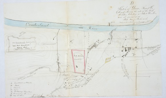
Sketch of Dover, Stewart Co. (Tenn.) Showing the Site of the U.S. Military Cemetery at Fort Donelson and Its Surroundings

- Creator: Frank James
- Title: Sketch of Dover, Stewart Co. (Tenn.) Showing the Site of the U.S. Military Cemetery at Fort Donelson and Its Surroundings
- Date: ca. 1866-1867
- Description: Hand-drawn pictorial map depicting part of the fort itself, the Cumberland River,and the town of Dover. A red line highlights a section labeled "military cemetery." Below it the word "Freestate" is written and in parenthesis: "camp of contrabands." The drawing is signed Frank C.? James, Chief?, Q.M. Dpt.
- Historical Note: This document is one of the very few to identify a location and approximate size for a "contraband camp." Such camps were often found near Union fortifications. Many African American former slaves and other persons who had escaped through enemy lines sought protection and sometimes employment as Union forces coming into the South. Since Tennessee was in the northernmost portion of the western war theater, some of the earliest contraband camps were established in or around strategic transportation corridors, such as at Dover, at Memphis, and at Grand Junction, an important railroad intersection between Memphis and Corinth, Mississippi.
- Contributing Institution: Fort Donelson, National Park Service
- Rights: Images reproduced on this website are intended for individual, educational use only. For research inquiries about specific objects or requests for high resolution images, contact Fort Donelson, National Park Service, or the National Archives & Records Administration.
- Digital Publisher: Digital Initiatives, James E. Walker Library, Middle Tennessee State University
- URL: http://cdm15838.contentdm.oclc.org/cdm/landingpage/collection/shades


