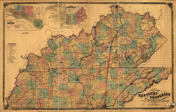
New map of Kentucky and Tennessee from authentic reports of county surveyors throughout the states of Kentucky and Tennessee with a new key for measuring distances and specifying localities

- Rights: New map of Kentucky and Tennessee from authentic reports of county surveyors throughout the states of Kentucky and Tennessee with a new key for measuring distances and specifying localities, Images reproduced on this website are intended for individual, educational use only. For research inquiries about specific objects or requests for high resolution images, contact the Library of Congress.
- Date: ca. 1861
- Description: Color map of Kentucky and Tennessee with insets of Memphis and Louisville. The completed railroad lines running from Louisville to Nashville, Nashville to Chattanooga, and Chattanooga to Bristol are depicted on the map in blue. A decorative border with details at the four corners surrounds the map.
- Historical Note: At the beginning of the war, East Tennessee was occupied by the Confederacy. Union sympathizers like Christopher A. Haun from Greene County Tennessee, carried out a plot to burn river and railroad bridges along the lines of the East Tennessee & Georgia and East Tennessee & Virginia railroads, shown here in blue as a continuous line, to impede the Confederate advance in November 1861.
- Contributing Institution: Library of Congress
- Digital Publisher: Digital Initiatives, James E. Walker Library, Middle Tennessee State University
- URL: http://cdm15838.contentdm.oclc.org/cdm/landingpage/collection/shades


