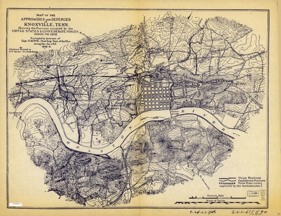
Map of the Approaches and Defences of Knoxville Showing the Positions Occupied by the United States and Confederate Forces During the Siege

- Creator: Cleveland Rockwell and R. H. Talcott
- Title: Map of the Approaches and Defences of Knoxville Showing the Positions Occupied by the United States and Confederate Forces During the Siege
- Date: 1863
- Description: Additional text: "surveyed by direction of Capt. O. M. Poe, Chief Engr Dept of the Ohio, during Dec. Jan. and Feb. 1863-4."
- Historical Note: In Tennessee, many sons of prominent Tennessee families had prepared for life as professional soldiers by attending military preparatory academies or obtaining commissions to West Point. When war was declared, they were automatically given rank in whichever army they chose to join. Those who trained at West Point had studied engineering and historical military tactics. The Union army purposely recruited skilled tradesmen into the Corps of Engineers to help build bridges, buildings, boats, and fortifications. Plans from both sides for fortifications and detailed maps and drawings have survived. Much of the military strategy targeted railroads and rivers. This map, drawn by Cleveland Rockwell and R.H. Talcott under the direction of Captain Orlando M. Poe, shows the locations of all of the forts surrounding Civil War Knoxville.
- Institution: Library of Congress
- Publisher: Digital Initiatives, James E. Walker Library, Middle Tennessee State University
- Rights: Images reproduced on this website are intended for individual, educational use only. For research inquiries about specific objects or requests for high resolution images, contact the Library of Congress.
- URL: http://cdm15838.contentdm.oclc.org/cdm/landingpage/collection/shades


