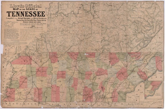
Lloyd’s Official Map of the State of Tennessee

- Creator: Lloyd, J.T.
- Title: Lloyd’s Official Map of the State of Tennessee
- Date: 1863
- Description: Map depicting major features, especially railroads, present in Tennessee during the Civil War. A large detailed section of Kentucky occupies the top part of the map, and the states surrounding Tennessee receive fringe coverage. Major battle sites in Tennessee are underlined in red.
- Historical Note: L. Virginia's diaries report on the toll that McMinnville's occupation by Federal forces--since April 1862--was taking on her health. In an effort to find a safer location, L. Virginia and her children moved from McMinnville, in Warren County, to Beersheba Springs, in Grundy County, to stay with their friends, Colonel and Mrs. John Armfield in the spring of 1863. They were living in Beersheba Springs when it was attacked by Union forces on July 26, 1863.
- Institution: Tennessee State Library & Archives
- Publisher: Digital Initiatives, James E. Walker Library, Middle Tennessee State University
- Rights: Images reproduced on this website are intended for individual, educational use only. For research inquiries about specific objects or requests for high resolution images, contact the Tennessee State Library & Archives.
- URL: http://cdm15838.contentdm.oclc.org/cdm/landingpage/collection/shades


