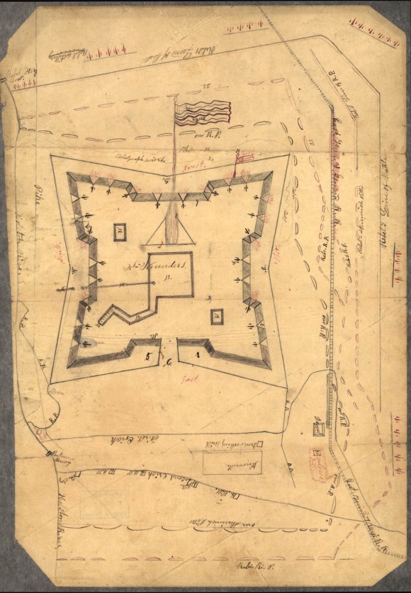
Map of Fort Sanders, Knoxville, Tennessee, Showing the Confederate Assault of Nov. 29, 1863

- Creator: John G. Orth
- Title: Map of Fort Sanders, Knoxville, Tennessee, Showing the Confederate Assault of Nov. 29, 1863
- Date: ca. 1863-1864
- Description: This hand-drawn map shows the plan of Fort Sanders from an aerial perspective. It is labeled with directional information, shows railroad tracks, and has symbols that appear to represent cannons drawn in red ink. Written on verso in lead pencil: Drawn by John G. Orth (Arcadia, Ohio). Went with Army 8/22/1862 for 3 yrs. Mustered out with Company 6/24/1865.
- Historical Note: Fort Sanders, which sat atop a fortified hill just north of the Kingston Pike in Knoxville, Tennessee, was built by U.S. Army troops under the direction of West Point-trained engineer Orlando M. Poe. Originally named Fort Loudon, Poe suggested changing the name to honor his friend Brigadier General William Sanders who was killed Nov. 19, 1863, ten days before Confederate soldiers were soundly defeated trying to regain control of Knoxville. This map includes the telegraph wires that Poe strung across the West side (top of this view) of the fort that tripped Confederate soldiers in their attack.
- Contributing Institution: Library of Congress
- Rights: Images reproduced on this website are intended for individual, educational use only. For research inquiries about specific objects or requests for high resolution images, contact the Library of Congress.
- Digital Publisher: Digital Initiatives, James E. Walker Library, Middle Tennessee State University
- URL: http://cdm15838.contentdm.oclc.org/cdm/landingpage/collection/shades


