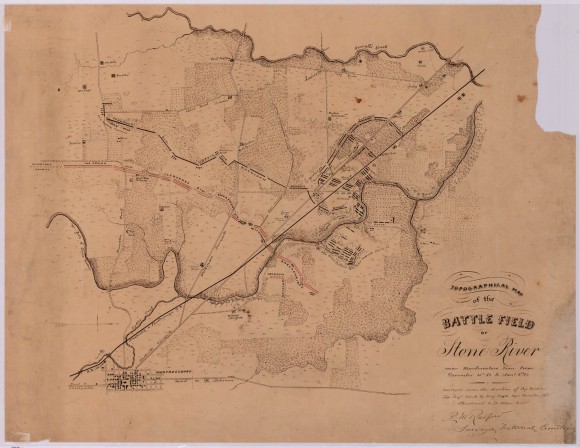
Topographical Map of the Battle Field of Stone River

- Title: Topographical Map of the Battle Field of Stone River
- Date: 1863-1865
- Description: This hand-drawn map shows positions of both armies, as well as geographical features of the area.
- Historical Note: This map, created under the auspices of the United States Army Corps, Topographical Engineers, is signed by Radford, Surveyor, National Cemetery. The names of Captain Michler and Major Wei(y)ss, as well as Captains Thruston, and Hinchcomb, and Lieutenant Allen, also appear under the title at lower right. Some months after the December 1863 Battle of Stones River, a monument and a small cemetery were created to honor those men in Colonel William B. Hazen's brigade who had died at Shiloh the previous April as well as those who fell at Stones River. The creation of a national cemetery at Stones River was overseen by Chaplain William Earnshaw and members of the 111th United States Colored Troops who began the work of re-interring Union soldiers in October 1865.
- Institution: Tennessee State Library & Archives
- Publisher: Digital Initiatives, James E. Walker Library, Middle Tennessee State University
- Rights: Images in these collections are either protected by copyright or are the property of Special Collections of Fisk University Franklin Library. To order a reproduction or to inquire about permission to publish, please contact the Tennessee State Library & Archives.
- URL: http://cdm15838.contentdm.oclc.org/cdm/landingpage/collection/shades


