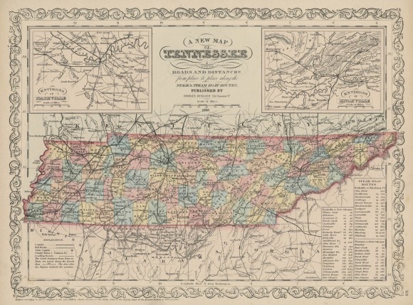
A New Map of Tennessee with Its Roads and Distances
- Creator: Charles Desilver
- Title: A New Map of Tennessee with Its Roads and Distances
- Date: 1860
- Description: Map of the state of Tennessee with insets for Knoxville and Nashville.
- Historical Note: Tennessee, with its networks of turnpikes, railroads, and rivers, afforded many opportunities for the transportation of troops and materials during the Civil War. Diarists like L. Virginia Smith French provided first-hand knowledge of troop movements.
- Contributing Institution: Vanderbilt University Libraries
- Rights: Images reproduced on this website are intended for individual, educational use only. For research inquiries about specific objects or requests for high resolution images, contact the Vanderbilt Special Collections and University Archives.
- Digital Publisher: Digital Initiatives, James E. Walker Library, Middle Tennessee State University

