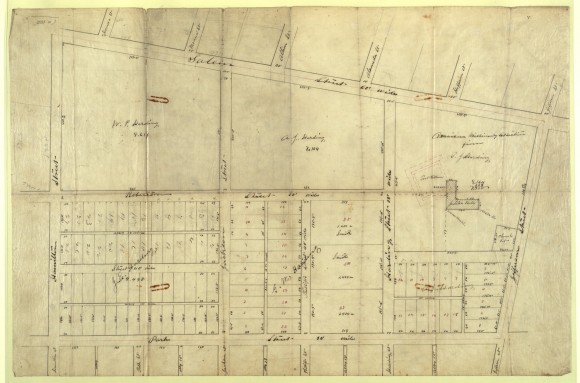
Property Map Showing Location of Early Fisk University Buildings

- Title: Property Map Showing Location of Early Fisk University Buildings
- Date: circa 1873
- Description: This street grid and property map shows a plat at upper right, labeled American Missionary Association, on which has been drawn the footprint of an ell-shaped building. Two large properties in the same section bear the name Harding. The streets bounding these blocks are named Salem, Jefferson, Harding, and Hamilton.
- Historical Note: This document not only shows the scale and plan of Fisk University's Jubilee Hall, it also shows it in relation to the "ghost" footprint of Fort Gillem, a federal fortification built for the defense of Nashville during the Civil War. Several of the earliest buildings on the campus of the Fisk Free School for African Americans, which was incorporated as Fisk University in 1867, were former army barracks.
- Institution: Nashville Public Library, Nashville Room, Henry Hibbs Papers
- Publisher: Digital Initiatives, James E. Walker Library, Middle Tennessee State University
- Rights: Images reproduced on this website are intended for individual, educational use only. For research inquiries about specific objects or requests for high resolution images, contact the Nashville Public Library.


